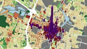
Urban3 was hired to conduct a value per acre analysis and create value projections for a proposed transit-oriented development project. Recognizing that Leander exists as a node connected to Austin, Urban3 also analyzed value per acre for Leander at the Austin scale. Our work often finds that smaller cities near large metropolitan areas struggle to figure out their place in the regional context. In Leander, using smaller neighbors as examples of what’s possible in terms of future development is more effective than comparisons to Austin.

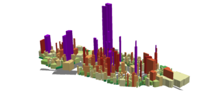
The Northline development was proposed as a mixed-use project in the Transit-Oriented Development Center near the last Austin MetroRail stop. The project was controversial because of the infrastructure costs, but Urban3 projected that the initial public investment would be repaid by the Tax Increment Reinvestment Zone by 2031 and visualized the potential growth in revenue.


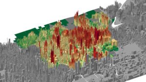
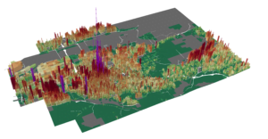
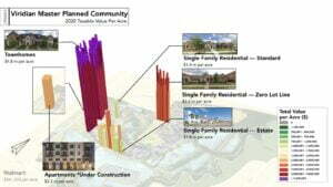
Leander is growing and the community must make decisions about how to grow. Urban3’s model allowed for quick comparisons of neighbors like Georgetown and Round Rock in terms of revenue productivity. The model allows Leander to use local examples of what kind of development leads to a solid main street core as a blueprint for future growth.

Outcomes
- The Northline development proposal was approved by the Leander City Council immediately following the presentation of Urban3’s work.
- Council members changed their minds about the viability of a transit-oriented development over sprawl development.